What You Need to Know Now :
A winter storm hit New York City on Sunday (Jan. 25, 2026) with snow intensifying through the afternoon.
Total accumulation forecast: 6–8 inches across the five boroughs, with isolated spots up to 10 inches.
Timing: Heaviest snow expected afternoon into evening, with the system moving out by ~9 p.m.
Observed totals (around 1 p.m.): Central Park 7.2″, LaGuardia 7.1″, JFK 6.0″.
Hazards: Snow mixing with sleet/ice, 1–2″/hour snowfall rates, and gusts up to ~35 mph.
Travel: Hazardous Travel Advisory in effect; officials urge residents to stay off roads and use mass transit only if necessary.
Transit updates: MTA is largely running, but outdoor tracks may see changes; buses are running locally with route reroutes.
Service suspensions: NYC Ferry suspended, Port Authority Bus Terminal bus operations suspended, Staten Island Ferry reduced to hourly.
City services: NYC public school students are remote on Monday; public libraries are closed Sunday and Monday.
Public safety response: Warming centers open (two per borough), outreach teams canvassing streets, and plow operations underway.
Winter Storm Dumps Up to 10 Inches Across New York City
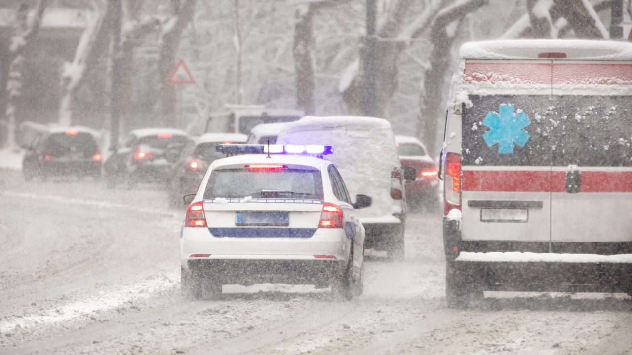
Snow began falling across New York City’s five boroughs Sunday morning and quickly escalated into a high-impact winter storm by the afternoon. Forecasters expect 6 to 8 inches of snow citywide, with some neighborhoods potentially reaching 10 inches before the system exits later tonight.
The storm’s most intense period is centered on Sunday afternoon through early evening, when snowfall rates may reach 1 to 2 inches per hour and wind gusts could push up to 35 mph, increasing drifting and reducing visibility. Weather officials also warn that sleet and ice may mix in during parts of the event, compounding risk on streets, sidewalks, and bridges.
By early afternoon, measured totals across key locations were already substantial: Central Park reported 7.2 inches, LaGuardia 7.1 inches, and JFK 6 inches. This marks the largest snowfall New York City has seen since Feb. 1, 2022, a benchmark that underscores the storm’s severity and the strain it can place on transportation and emergency services.
Officials Issue Strong Warnings: “Brutal, Bone-Chilling, and Dangerous”
State and city leaders framed the storm as more than an inconvenience—it’s a safety threat. Gov. Kathy Hochul described conditions as dangerous, highlighting a broader pattern of extreme winter weather that includes a prolonged cold stretch and unusually high totals in parts of the region.
While widespread power failures are not expected, officials cautioned that isolated outages remain possible—especially where ice and wind stress trees and utility lines.
Mayor Zohran Mamdani urged residents to stay indoors whenever possible and avoid nonessential travel. City officials stressed that too many vehicles on the road increases the risk of crashes and blocks plows and emergency response.
A Hazardous Travel Advisory remains in effect through Sunday and Monday, as cold temperatures can rapidly refreeze slush and meltwater, turning surfaces into ice.
Ice, Sleet, and Freezing Rain Increase Risk After Snowfall
This storm isn’t only about snow totals. The projected shift toward sleet and freezing rain late in the event raises concerns about:
Black ice on untreated roads and sidewalks
Treacherous bridges and elevated roadways (which freeze faster)
Hazardous conditions for pedestrians, especially on stairs, curbs, and transit entrances
Reduced traction that impacts buses, emergency vehicles, and plow operations
Even after the precipitation ends, the real danger can continue—because extreme cold helps snow and ice stick around longer and makes cleanup slower.
Transit and Commuting: What’s Running, What’s Limited, What’s Suspended
Despite the intensity of the storm, the MTA reported mostly regular operations, with an important caveat: outdoor tracks may trigger service changes if conditions worsen. Many subway lines are operating locally during the storm, and bus service is operating under storm-mode adjustments.
Key transit impacts reported include:
Most bus lines run locally, with select diversions
18 bus routes rerouted due to conditions
NYC Ferry service suspended until further notice
Bus operations at the Port Authority Bus Terminal are suspended
Staten Island Ferry reduced to hourly service
For riders, the practical takeaway is simple: even when service is technically “running,” winter conditions can create delays, detours, and sudden changes, especially in exposed areas and terminals.
Schools and Libraries: Remote Learning and Citywide Closures
To reduce travel risk and keep families off roads, the city announced:
NYC public school students will have a remote day on Monday
NYC public libraries will be closed on Sunday and Monday
These decisions align with a public safety strategy designed to lower traffic volume, reduce slip-and-fall emergencies, and allow crews to clear streets and transit routes faster.
Warming Centers and Outreach: City Expands Cold-Weather Protection
With frigid temperatures and reports of people found deceased outdoors, the city expanded emergency cold response measures. Officials confirmed:
10 warming centers are operating (two in each borough)
Centers are expected to remain open at least through Monday evening
Food is provided at each location
City workers are canvassing streets to locate and assist unhoused residents
The message from city leadership is direct: prolonged exposure in extreme cold can become fatal quickly, especially when wind and wet clothing accelerate heat loss.
Snow Removal and Emergency Response: Multi-Agency Coordination Underway
City operations are in full winter-storm mode, with agencies coordinating through NYCEM and related emergency management channels. Officials outlined a broad response that includes:
DOT crews are prioritizing bridges and critical roadways
Parks Department teams are removing fallen branches and clearing park pathways
NYPD is supporting EMS and sanitation operations where escorts are needed
FDNY is maintaining a full emergency response capability
Sanitation and plow teams are clearing road networks and supporting accessibility routes
Residents are also being encouraged to shovel safely and pace themselves, as heavy snow plus extreme cold increases the risk of overexertion and cardiac events.
Tri-State Snapshot: Snowfall Spreading Across NY, NJ, and CT
Across the Tri-State area, accumulating snow has been reported from New York City through northern and central New Jersey and into parts of Connecticut. Early reports indicated pockets of higher totals in sections of New Jersey, while areas north of the city—such as parts of Westchester and Rockland—also saw steadily rising accumulations.
The storm’s footprint reinforces a key point for travelers: this isn’t a localized NYC event. Regional roads, airports, and intercity transit can be affected simultaneously, especially when temperatures remain below freezing.
What Happens Next: Storm Exits, Cold Lingers
Forecast guidance indicates snowfall will taper off by Sunday night, but the cold pattern continues. With temperatures expected to remain near or below freezing into the coming days, whatever falls will persist—keeping streets and sidewalks icy and making cleanup a multi-day challenge.