
Summary: Nor’easter Watch: Heavy Snow and Freezing Cold Heading for New England
Snow totals: Boston and Southern New England saw nearly 2 feet of snow, adding to the region’s recent snow accumulation.
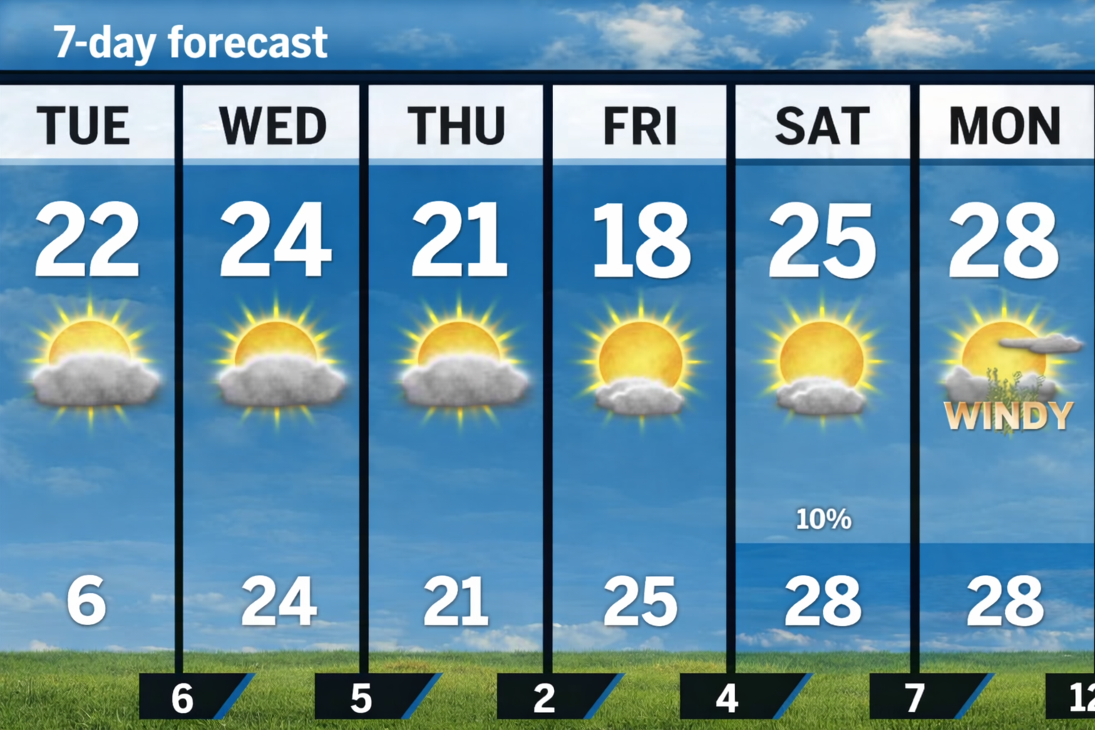
Cold temperatures: A lingering breeze and icy temperatures will keep wind chills well below freezing throughout Tuesday.
Light snow expected: A low-pressure system over Canada could bring light snow showers to parts of New England, especially Western Mass and Northern New England.
Wind chill warnings: Wind chills will remain negative, making conditions feel like an arctic tundra.
Nor’easter watch: Forecasters are closely monitoring the possibility of a significant nor’easter storm this weekend, with snow, heavy winds, and coastal flooding.
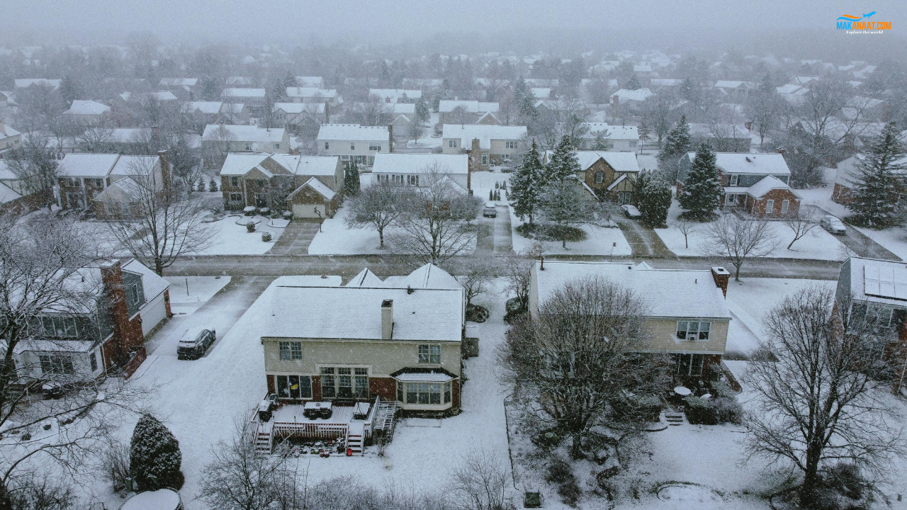
Storm aftermath: The region experiences a mix of sun and clouds, but the snowpack remains, and temperatures remain below freezing.
Forecast uncertainty: While the models differ, the storm is expected to be impactful, with some forecasts predicting over a foot of snow and strong winds.
Nor’easter Watch: New England Prepares for More Snow and Bitter Cold
As New England recovers from a massive snowstorm, residents in Boston and the surrounding areas are facing yet another potential winter storm on the horizon. The recent storm brought nearly 2 feet of snow to parts of the region, setting records and significantly impacting daily life. The snow emergency from earlier this week has passed, but the cold temperatures and snowpack remain, leaving much of the region in a frozen state.
Cold and Breezy Conditions Across New England
Tuesday will see a mix of sun and clouds, but the icy conditions are far from over. A persistent northwesterly breeze will funnel in Arctic air, keeping temperatures well below freezing across New England. Winds will range from 10 to 15 mph, making wind chills dip into the negatives throughout the day. This will create dangerously cold conditions, especially for those waiting outdoors for public transportation.
The temperature highs across Greater Boston will only reach the low 20s, with wind chills making it feel even colder. The situation will be similar across the region, with Southeastern Massachusetts, Rhode Island, and Central Massachusetts all experiencing highs in the low 20s, but with wind chills making it feel much colder.
Potential for Scattered Snow Showers
While Tuesday will mostly remain dry with a few breaks in the clouds, a low-pressure system over Canada may bring scattered light snow showers to the region. These snow showers are expected to accumulate just a coating to an inch, mainly impacting Western Massachusetts and Northern New England. This light snow will not significantly affect daily operations but could add a dusting to an already snow-covered landscape.
Looking Ahead: Nor’easter Watch for the Weekend
What’s next? Forecasters are closely monitoring a potential nor’easter that may develop later this week and impact New England over the weekend. A dip in the jet stream is expected to spark another coastal storm, but this time, the system is forecast to develop farther east, which could bring much stronger impacts for the region.
The exact storm track remains uncertain, with forecasting models showing some discrepancy. However, if the storm shifts closer to New England, it could bring heavy snow, strong winds, and even coastal flooding. While it’s still early to make firm predictions, some models are forecasting over a foot of snow for parts of the region, along with blizzard conditions and strong gusts.
The potential for coastal flooding adds another layer of complexity, as rising tides and gusty winds could make conditions more hazardous along the shoreline. Forecasters urge New Englanders to stay prepared for possible disruptions, particularly in the event of a direct hit from the storm.
Storm Aftermath and Impact on Daily Life
After the snowstorm, New Englanders are dealing with the aftermath, which includes an icy landscape and few places to park or walk. Despite some sunshine, temperatures will remain cold for the next few days, which means the snow will not be melting anytime soon. The snowpack will continue to shift across roads and fields due to the persistent winds, and residents should be cautious of drifting snow.
The region is in for a challenging week as the temperature remains low and another major storm looms on the horizon. As forecasters continue to track the weekend storm, residents need to stay informed and be prepared for more snow and potential disruptions to daily life.
References:
https://www.bostonglobe.com/2026/01/26/metro/boston-forecast-cold-storm-noreaster/
https://weather.com/storms/winter/video/weekend-noreaster-east-coast-snow-wind